Segment Descriptions
I’ve written brief descriptions of the trail split into segments. These segments follow those on the official maps from Trails SA, and also the daily schedules of the BikeSA Outback Odyssey. They are by no means proscriptive, but on the other hand they generally start and end at good places to stay, and are achievable without drama by those with a decent level of fitness. (“And what the hell is a decent level of fitness?” You ask. I could not find an objective scale, so I created one. By decent I mean 4-5 on my scale.)
How fit do I need to be?
You are fit enough. There, I’ve said it. There’s no reason not to ride the trail.
More important than absolute fitness levels is an ability to match your attempt to what your body can handle.
I’ve found it’s hard to look at a website and work out from that how much you should attempt each day, so I made an objective scale to help you work it out. (see handy hints to the right) If you’re aiming for daily segments as I’ve described below, Id say you should be level 4-5 on my scale.
I’m a level 5 in the scale, and in good conditions the segments below for me are fine.
As I’ve said though, experience is the main thing. You need to know what 100km on dirt roads feels like, how to pace yourself when a headwind comes up, how not to blow up on a climb, etc. If you’re an experienced rider all this is obvious, if you’re not, you can still do the ride. (how else will you gain experience?)
I rode the segments described below in 2015 (and revisited many in 2016). Leading up to my first ride of the trail, my training rides were roughly 40-60km each, two or three times a week and with 1000m or so of vert on each ride. I experimented with a couple of 100+km days with a loaded bike to see how that felt.
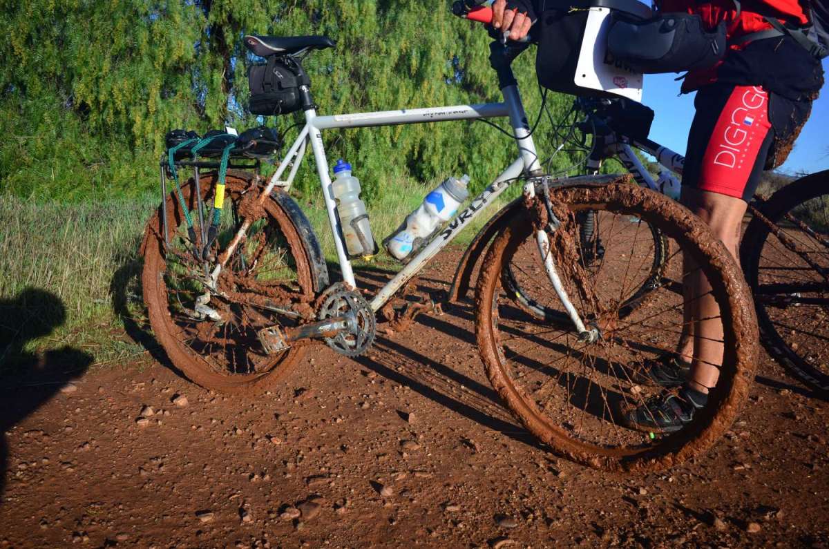
Conditions play a huge part though. If you’re riding bitumen you only have weather, wind, temp etc. to factor in. On the Mawson you also have the condition of the track. Remember – it can be so muddy that not only is it unridable, but it’s unwalkable as well, as your bike turns in to a heavy, bike-shaped object with wheels that won’t turn on a surface where you have no traction to try and push it.
Try to avoid getting in to that situation. Use caution. Once per lifetime is often enough to tackle thick mud on the Mawson. It might sound like a grand adventure, but remember, that’s what the diggers thought about going to the Western Front in WWI.
For less experienced riders, here are my handy hints:
The trail itself is not likely to kill you; trucks and cars can kill you really quickly though. The point I’m making is that if you’re sensible about when and where you ride, avoiding high traffic and/or low visibility situations, you’ll be fine. Or at least not dead, and if you’re not dead you can be bike touring, which is fun, so enjoy it.
After a couple of hours see what you’ve done and use this to gauge what needs to be done for the rest of the day.
When mud blocks the track and you need to push the bike for 10km? When you snap a derailleur and have to ride 50km in one gear?
You are not Wiggins aiming to die on the line with nothing left to give, you want to get there with as much in reserve as possible. You might need to do it all again tomorrow.
“As much as you can,” is a good rule of thumb. The old adage that if you feel thirsty you’re already dehydrated is pretty good. Make sure you’re pissing a lot and it does not look too yellow. (Gross, I know, but we don’t want you falling off the bike dead).
You’ll discover what foods suit you, but high energy, easy to digest carbs are a good place to start. Eat often; again, don’t wait until you feel hungry. Think of those jolly Italian racers with the big bowls of pasta and litres of red wine at the end of each day – they knew a thing or two.
(By the way – some people will say alcohol and coffee are bad because they dehydrate you. I say screw those people.)
- I am able to ride a bike, but do so rarely. I am nervous braking down hills and would probably walk up any inclines.
- I ride occasionally and am confident changing gears and braking on smooth surfaces with low traffic. I can ride for 2 hours without discomfort.
- I ride regularly on public roads and gravel paths and find 50km with some climbing quite manageable. I am unsure how I’d go on an extended trip, and I need help with fixing flats and adjusting my bike.
- I am an experienced rider and on tarred roads I find 75km with some hills quite manageable. I can fix flats, and adjust my gears and brakes.
- I am an experienced tourist with bike handling and maintenance skills to cover unmade roads and tracks. On unsurfaced roads I would expect to cover 50 – 100km for extended periods with occasional rest days.
- I am an experienced tourist with bike handling and maintenance skills to cover rough unmade roads and tracks. On unsurfaced roads I would expect to cover 100km or more per day self-supported for extended periods.
- I take part in endurance events on mixed surfaces and would expect to cover 200km or more each day self-supported for extended periods.
Going Down?
I’ve written these segments for the traveller going north, but I’ve also done many segments north to south. One way is no better than the other – it just depends on conditions and your schedule. North to south is definitely an option. Why? The sections where you need to carry the most water are up there, and it gets easier and more civilised as you get closer to Adelaide. Another good option might be to start at Wilpena, go to the top and come back down again. The Flinders Ranges really are special, and the rides in and out of Wilpena are stunning. My next trip is planned around there, just doing the odd section or two, and maybe heading down south to Melrose. There are lots of good options for short rides if you don’t have time for the whole trail.
BikeSA Outback Odyssey
I rode the Outback Odyssey in 2015. If you’re thinking about doing it, my observations are at this link
Adelaide to Lobethal (50km)
A journey of 900 km starts with a great coffee
The Mawson Trail officially starts a little north of Adelaide, but the smart money is on a city departure. Adelaide has a great bike path, part of the Linear Park that follows the River Torrens up to the Adelaide foothills and takes you to the start of the trail. The Linear Park starts on the coast near Glenelg, so you can pick it up from there, from the airport, CBD, or the train station.
Just follow the path to its end on Gorge Rd, and then ride and extra couple of km to where the Mawson markers start.
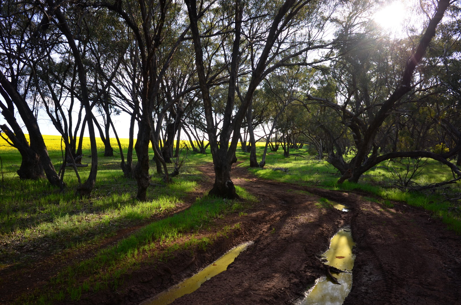
Be warned; the first section of the trail is brutal. There is no shame in walking these climbs. These are the among the toughest climbs you’ll encounter anywhere on the trail, so settle in, push your bike the worst of it and enjoy the spectacular views.
Once things settle down it’s straightforward into the hills town of Lobethal.
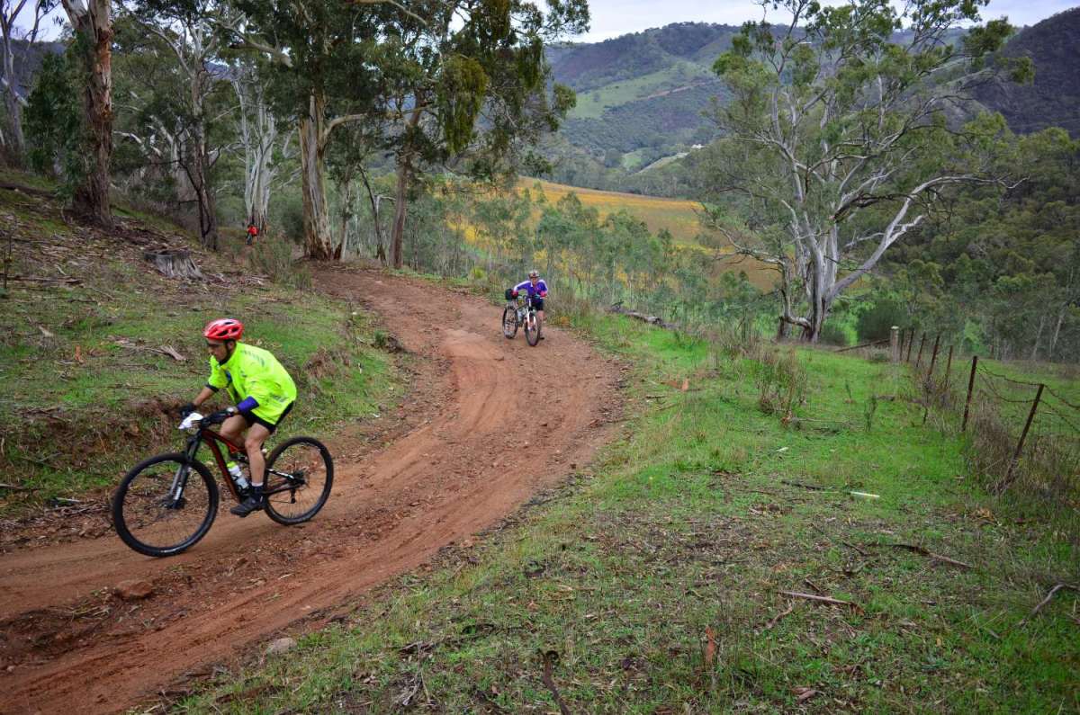
Lobethal to Tanunda (75km)
A gentle and indicative day
There are some lovely views out of Lobethal. You travel through the town of Birdwood and the Mount Crawford Forest Reserve then have a lovely climb on some nice sandy roads with spectacular views across the Barossa valley. The latter part of the day has a descent and then some more dirt into the town of Tanunda. You’re only an hour by car from Adelaide at this point, so there is still the feel of a close connection to the city.
Beware of the road if it has been raining – the roads west of Rowland Flat leading into Tanunda can become muddy. This is the kind of mud that can stick to everything, stop wheels spinning and snap derailleurs, so if you strike these conditions you need to develop your level of pragmatism about following the trail proper or sneaking a few km on the bitumen.
Tanunda to Riverton (75km)
Yep – this is what I signed up for
Up the bike path you go to Nuriootpa (“Nuri”), then along some relatively uninteresting roads into the very interesting town of Kapunda; an early mining town with some fine old public buildings to show for it.
After Kapunda things go from good to better:
There’s some standard gravel roads, a bit of climbing on dusty clay (read wheel-clogging mud if it’s wet) a smidge of bitumen and then a couple of segments of unmade road winding through beautiful gums.
Ah! If this is the Mawson then bring it on…
There are some unmade vehicle tracks after this. Nothing too tricky, just interesting. Again – impassable in mud, so be warned. If ridable they’re great. Really nice section: MAWSON GOLD in fact.
The last 10-15 km is from the high ground to low, on nice smooth roads; some gravel, some unmade. A good finish to the day if you’re staying in Riverton for the night.
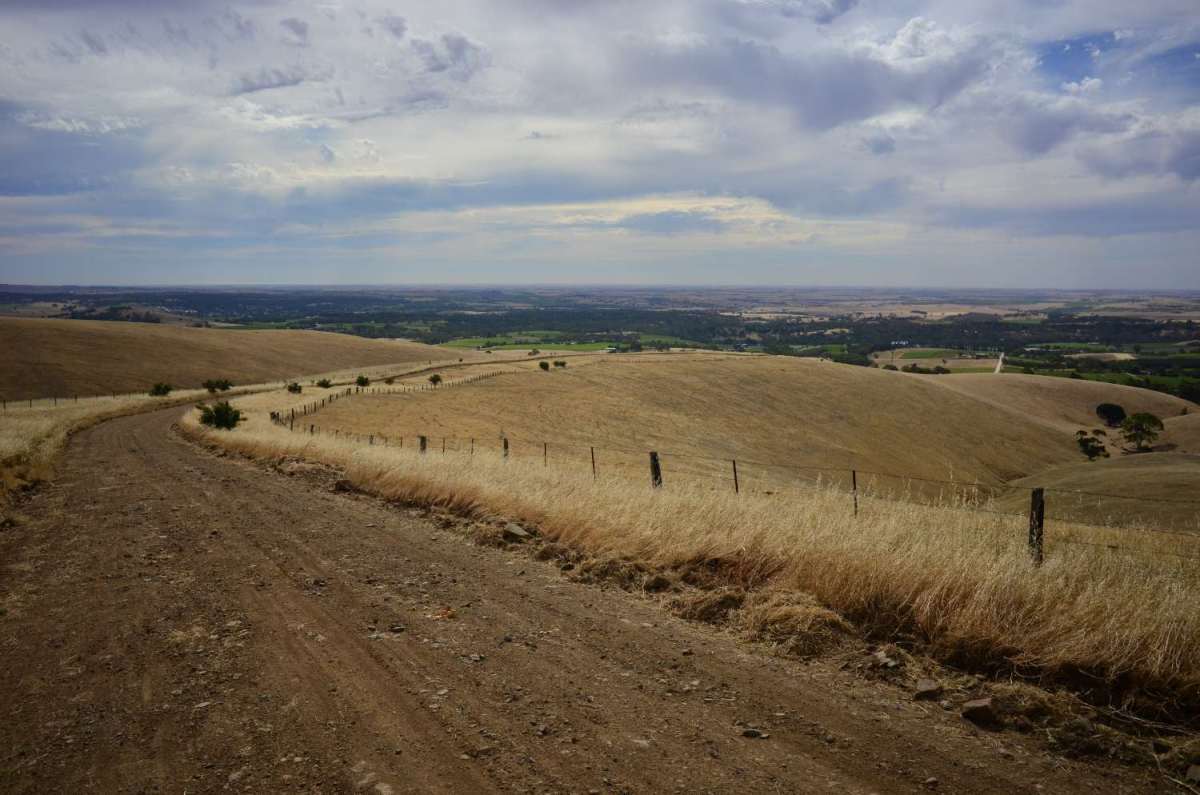
Riverton to Clare/Burra (45km/95km)
It’s the Mawson Jim, but not as we know it
The Rattler is a rail trail that starts in Riverton. The official route from Riverton was laid out before the Rattler was built, but take the Rattler instead from Riverton to Auburn. Then take the Riesling trail to Clare.
Riverton to Clare is the softies’ leg of the journey. Non-cyclists like this part because it’s flat, well surfaced and has no traffic. There are coffee shops, wineries, and bakeries.
The Clare region is a good place to stay if you have a non-riding partner or group of friends because there are lots of things for them to do, and it’s less than two hours from Adelaide.
The ride from Clare to Burra is back on Mawson proper. The last 20 or so km into Burra are superb, up or down. There’s a lovely range to cross; not super steep, but good unmade track and uber-good views. Be careful, though; this bit will be dodgy after heavy rain. MAWSON GOLD.
Burra to Hallet (85km)
Goodbye gonads, Hello Sir Douglas!
Burra is something of a Mecca for gonads (grey nomads – yes?). Here you’ll see any number of caravans and RVs in and about the town and caravan park, as the gonads head up to the Flinders Ranges. As a corollary to gonads you get decent cafes and bakeries. There is also a range of accommodation as an alternative to staying in Clare should you prefer.
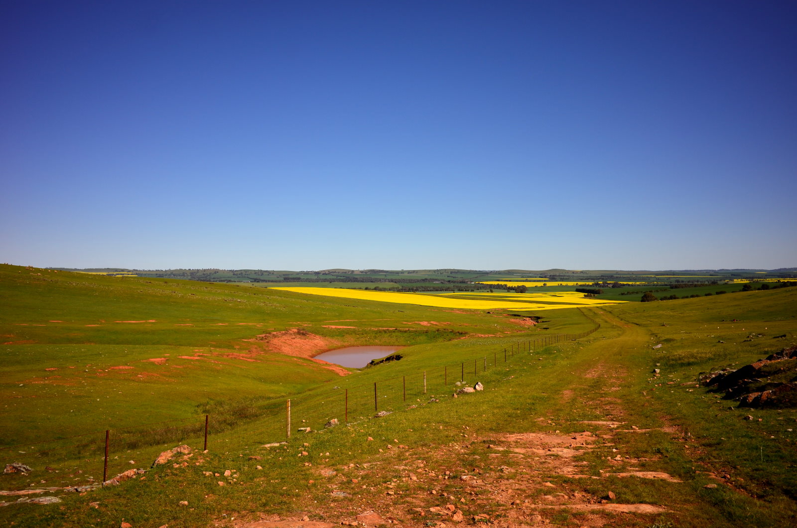
This is a lovely section with great scenery, firm gravel roads and rolling hills. The colours of the land start to change around here too; the yellows and blues of the Mid North start to overtake the greens and browns of the south.
Hallet to Spalding (50km)
How green was my valley
This is a pretty short leg, but there’s a fair climb and then a lovely descent into a valley with a wind farm on the other side of it. Nice roads, very pretty. The last bit runs along the old Bundaleer irrigation channel. It’s easy to miss the turn off to that. No drama if you do, as the main road will take you in to town, but the channel is worth seeing and it’s nice to get away from the road. The Spalding general store is worth mentioning; very good food, which can start to get a bit scarce as you head further north.
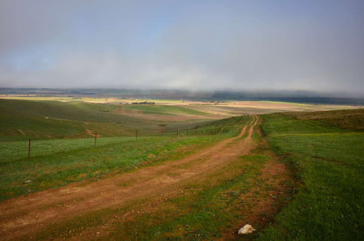
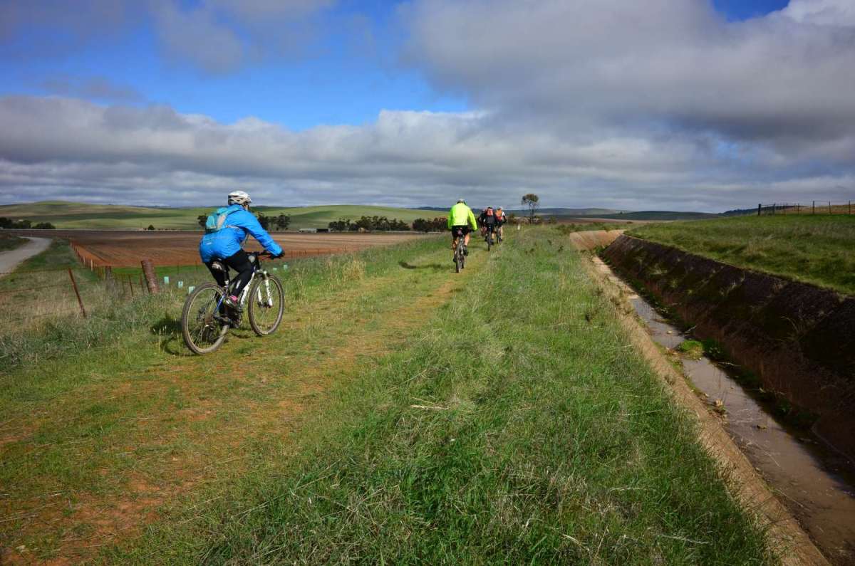
Spalding to Laura (80km)
Tell Laura I love her (ice-cream)
Leave Spalding along the Bundaleer channel. (Note – irrigation channels ipso facto have gentle gradients, yes?) The channel is pretty interesting, and then there’s a long steep climb through a valley, an excursion in the Bundaleer forest and across some grasslands. This is a very nice day’s riding. The last 30 km into Laura is pretty cruisy along some nice dirt. Laura, for those who may not know, is the spiritual home of Golden North Honey Ice Cream.
Three Corner Jack Alert: The parts along the Bundaleer Irrigation Channel in and out of Spalding are famous for spiky prickles (Calthrop, which we call Three Corner Jacks) At certain times of certain years these can be really bad along the channels. I have never encountered them, but a couple of guys I spoke to in April 2017 had just been hammered.
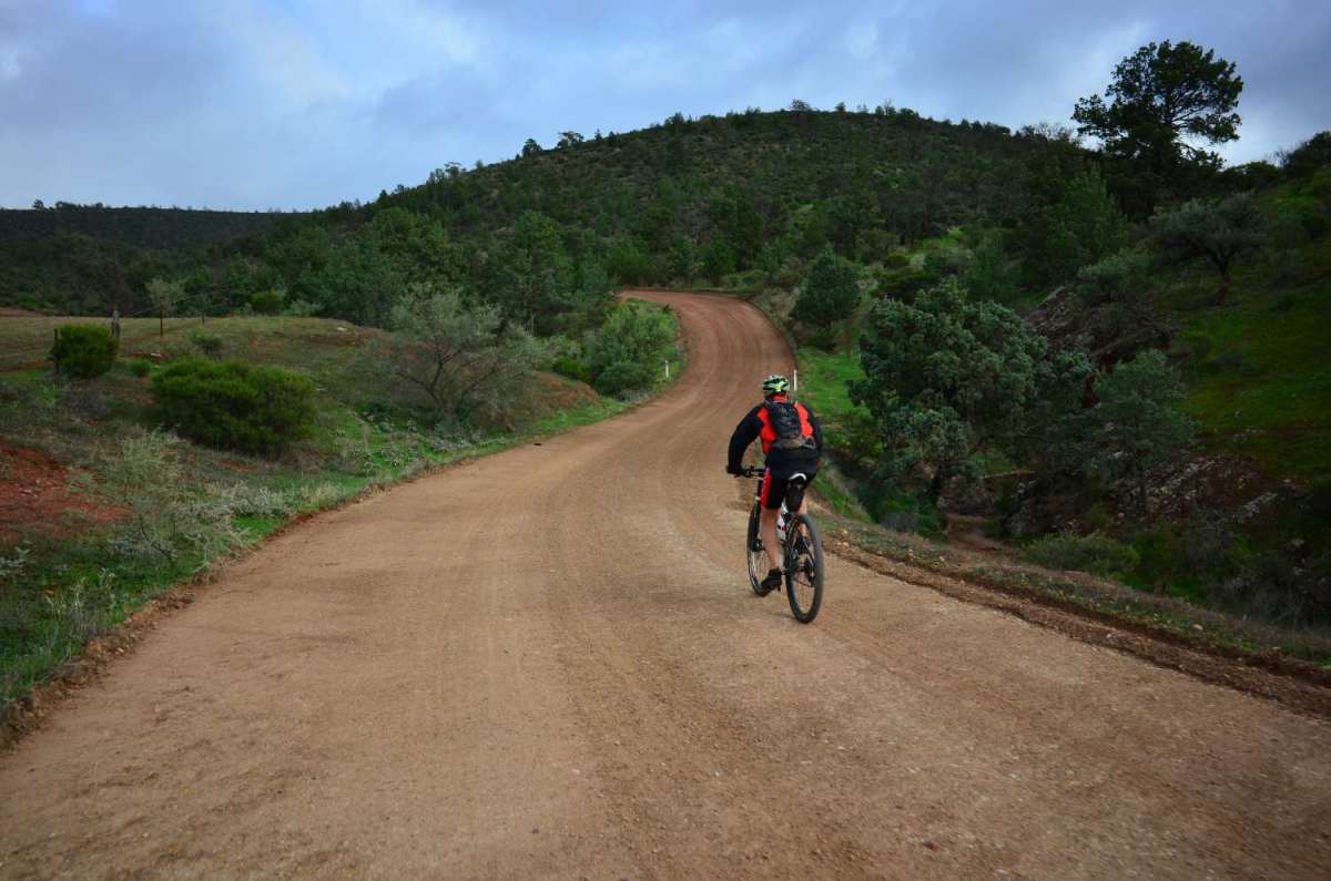
Laura to Melrose (60km)
Under a Northern Star
The day starts flat, and then kicks slightly to the west for another bit of MAWSON GOLD. It’s got some climbing, and few sections that might even be termed “technical” as you need to pick a line along rutted and stony vehicle tracks. (Another mud alert for this bit in the wet, though.) The trail then goes though the Wirrabra forest. A picturesque but unremarkable bit after that, generally on good roads.
Then you cross the Germein Gorge road, and have a lovely ride in to Melrose.
Melrose is a bit of a mountain biking hub. There are constructed tracks for all levels of riders, and competitions and events are held there regularly. There’s a very good bike shop “Off the Edge” with knowledgeable and helpful guys if you need bits or repairs – last chance for that. A couple of pubs and a nice caravan park nestled next to Mt Remarkable. Again, Melrose is a good spot to consider an extended stay. No IGA though.
UPDATE: April 2018. Melrose now has a pretty good shop as part of the servo. Opens 8.30 – 17.00 from memory so you can restock.
Melrose to Quorn (75km)
Country roads, take me home
The Mawson from Melrose to Wilmington is pretty boring so the (under construction) rail trail could be a good option. Update: May 2016- April 2018 – The new rail trail from Melrose to Wilmington is ridable. I rode it again early April 2018 and it’s now pretty good. Mostly the trail follows the access track next to the old line, but close to Wilmington it’s a rail trail proper. Work is being done from the Wilmington end so it will gradually improve. At this stage I’d say it’s a bit better than the Mawson, and probably more likely to be ridable in the mud. It now has all the metal bridges in, but some bits of surface are a bit dodgy. I don’t want to bag out the first section too much; I pushed through a lot of mud the first time I did it and that put me off. Later in the day I missed a section of the Mawson (probably the most interesting bit I should add) due to more mud, so that might have been good. The last bit is bitumen. This section is OK, but not a bucket list day.
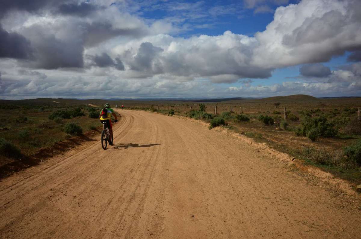
Quorn to Hawker (110km)
So close I can taste it.
A leg of long, flat roads. While the roads are not that interesting, the scenery is.
The Flinders Ranges begin to make themselves known to the east, as you ride up a valley and lovely blue/green rolling hills welcome you to the land that is to follow.
This is a transition day to the interesting stuff that starts north of Hawker.
The 110km might sound tough, but the roads are pretty easy. There’s a nice section before Craddock, but the last 25km into Hawker is just a flat slog on a dead straight dirt road.
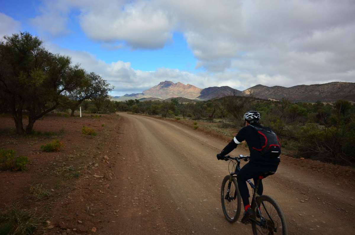
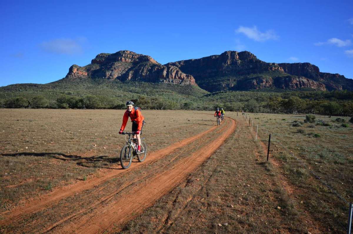
Hawker to Rawnsley Park (90km)
Ah, we’re in the Flinders
This is a very round-about section. Have a look at the map, and consider options if the weather is shitty. I’d say it’s all about the scenery – you spend a lot of time with nice views of the Elder Range on your right at you go north, and again from the other side as you travel south.
The roads themselves aren’t that interesting to ride and if you encounter rain or strong winds you may question whether the extra distance is worth it. It’s a pretty boring flog up the bitumen as an alternative though.
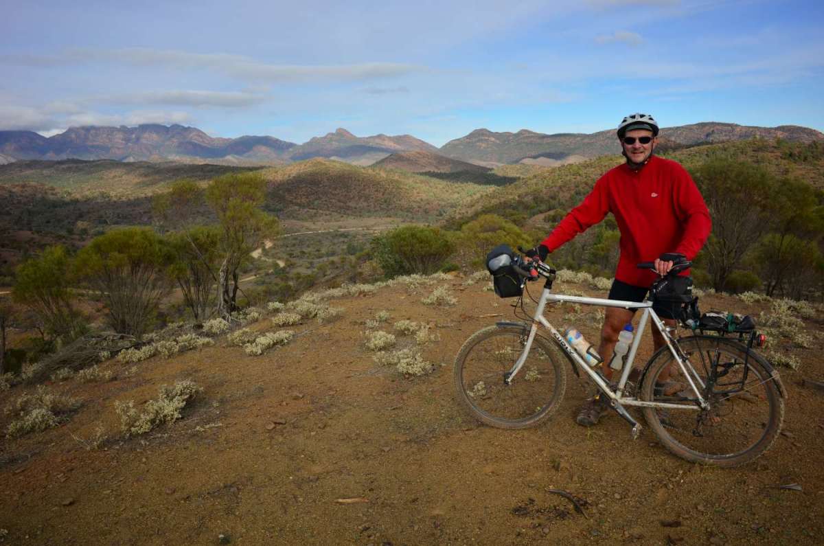
Rawnsley Park to Wilpena (Ikara) (27 km)
Now we’re talking Mawson
This is a very short section, but damn it’s good.
Leaving Rawnsley you have real singletrack. (Oh yes, you brought that mountain bike up here for a reason.)
Lovely riding and a spectacular backdrop of the bluff. Slip a short way up the bitumen and it’s on to the old telegraph road. This is an unmade vehicle track and a delight to ride. There’s a bit of bitumen into Wilpena to finish with. It might be tempting to press on or combine this section with another, but nah- it’s a lovely bit of riding and very special up here, so slow down and enjoy this bit. MAWSON GOLD.
Wilpena is a little hub of civilization (and bubble of Telstra phone coverage) which you won’t find again.
I would seriously consider spending a bit of time round Rawnsley/Wilpena (Ikara), maybe doing some loops or whatever if you have time. Remember also that if you’re based in Adelaide you can drive up and be here early arvo for a short stay riding some spectacular country.
Wilpena to Blinman (67km)
We’re in the outback now
There’s more mountain biking to be had early – usually an unmade vehicle track, but some singletrack and challenging exits and entries from creek beds. If you’re heavily laden or have a trailer expect some pushing. After that it’s mainly fire track, quite well made but some stony surface. MAWSON GOLD.
There is a super climb and hum-dinger views of the Heysen and ABC ranges. The last 20km to Blinman is bitumen, and you’re out of the best of the scenery by then.
Blinman – ah, what a town (not).
Well, at least there’s a pub. This is where the Mawson trail ends, or starts, so you can say you’ve done it once you’re here. It’s rather marginal in terms of amenities and resupply. As a base for exploring further by bike, Wilpena would be my choice. If it’s piqued an interest you might want to go on from Blinman to Arkaroola, or use Wilpena as a base to hit up some more of the areas that are accessible from there.
Another idea is taking the dirt main road to and riding on further to Parachilna, where the Prarie Hotel offers quite a haven, and there are community camping options if you’re waiting for a bus back to Adelaide.